

SkyMap – digital twin for construction
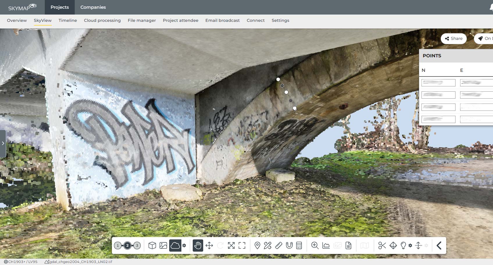
SkyMap turns drone scans into georeferenced digital twins for construction projects in the cloud – including 3D visualisation, construction progress monitoring and machine control integration.
- For construction progress monitoring, quantity take-off and quality assurance
- With cloud processing, ±30 mm accuracy
- Compatible with all common drone platforms and machine control systems
What applications is SkyMap designed for?
SkyMap is suited to construction companies, clients and planning offices that want to document construction progress seamlessly, calculate quantities precisely and feed drone data directly into machine control and planning – without photogrammetry know-how and without expensive local infrastructure.
Typical workflows with SkyMap
SkyMap’s strength lies in the simple, end-to-end connection of drone scan, cloud processing, 3D visualisation and machine control – with no data silos, no specialist knowledge and no local hardware investment.
SkyMap Cloud-Processing + SkyView for construction progress monitoring
For weekly or monthly drone scans with automatic cloud processing and direct comparison of planned and as-built status in the 3D model – for clients, site managers and planners.SkyMap Connect for machine control integration
For seamless export of terrain models and planning data directly into machine control systems – for civil engineering contractors who control excavators and graders on a model basis.SkyMap Design for measurement and your own drawings
For creating your own drawings, sections and models directly on the basis of the georeferenced digital twin – without an external CAD environment.SkyMap OnSite for field documentation
For foremen, site managers and supervisors who want to access the current digital twin on site via tablet or smartphone, document defects and assign tasks directly in the context of the 3D model.Why SkyMap stands out for construction companies and clients
SkyMap is the only platform that combines cloud processing, georeferenced 3D viewing, drawing creation and machine control export in a single construction SaaS solution – simple enough for any foreman, precise enough for the surveyor.
No local photogrammetry know-how, no special hardware, no installations – upload drone images and SkyMap takes care of the rest
±30 mm accuracy with GCP-supported georeferencing – equivalent to a classic GNSS rover pole for construction surveying
Cloud processing without tying up your own computer – keep working while SkyMap processes in the background
Time-based comparison of multiple drone scans for complete, traceable construction progress documentation over the entire project
SkyMap Connect for direct, seamless data flow into machine control systems – without manual format conversion or intermediate steps
All project stakeholders – client, planner, site manager, foreman – work on the same georeferenced model, anywhere and on any device
Frequently asked questions about SkyMap
Here we answer the most important questions about features, compatibility, accuracy and introducing SkyMap in your organisation.
Who is SkyMap suitable for?
Which drones and platforms are compatible with SkyMap?
What accuracy does SkyMap achieve?
Do I need photogrammetry skills for SkyMap?
Does trenderia also support demos, training and roll-out?
Request your SkyMap solution now
Whether evaluation, demo, configuration or quote: we help you set up SkyMap to suit your construction project and your workflows.