Fully integrated LiDAR solution for Matrice 300 RTK: Zenmuse L1

Fully integrated LiDAR solution for Matrice 300 RTK: DJI Zenmuse L1 Lidar and RGB solution.
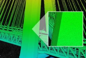
Superior accuracy for aerial surveying.
The Zenmuse L1 combines a camera with a 1-inch CMOS sensor, a Livox Lidar module, and a high-precision IMU. This is mounted on a 3-axis stabilized gimbal.
From the combination Matrice 300 RTK and DJI Terra forms a complete solution for the L1, providing you with real-time 3D data throughout the day, efficiently capturing details of complex structures and delivering highly accurate reconstructed models.
Key Features
- It integrates a lidar module, an RGB camera, and a high-precision IMU.
- High efficiency, 2 km² covered in a single flight
- High precision
Vertical accuracy: 5 cm / Horizontal accuracy: 10 cm / Point rate: 240.000 points/s
Supports 3 returns - Detection range: 450 m (80% reflectance, 0 klx)
- IP44 Ingress Protection Level
- Point cloud live view
Digitizing without compromise
Exceptional efficiency
Generate real-time point cloud models or capture 2 km² of point cloud data in a single flight with the Livox frame lidar module with a 70° field of view and a visible light camera with a 1-inch sensor.
Unprecedented accuracy
Render centimeter-accurate reconstructions thanks to the high-precision IMU, a vision sensor for positioning accuracy, and the inclusion of GNSS data.
Ready when you are.
The IP44 protection rating allows the L1 to operate in rainy or foggy environments. The lidar module's active scanning method enables night flying.
Visualize data while flying
Livox Lidar module
- Frame Lidar with up to 100% effective point cloud results
- Detection range: 450 m (80% reflectance, 0 klx) / 190 m (10% reflectance, 100 klx)
- Effective scoring rate: 240.000 points/s
- Supports 3 returns
- Line scan mode and non-repeated scan mode

Everything in view – RGB camera
- 20 SM
- 1-inch CMOS
- Mechanical closure
Precise information at your disposal – highly accurate IMU
- Accuracy: 0,025° (Roll / Pitch) / 0,08° (Yaw)
- Vision sensor for positioning accuracy
- GNSS, IMU, RGB data fusion
Recreate the world in 3D point clouds.
Point Cloud LiveView
Real-time point clouds provide immediate on-site insights, keeping operators informed to make critical decisions quickly. They can also verify the quality of fieldwork by reviewing the point cloud data immediately after each flight.
Measurement and annotation
Capture and communicate critical dimensions in the point cloud model using measurements and annotations.
One-stop post-processing
DJI Terra merges IMU and GNSS data for point cloud and visible light calculations and also performs POS data calculations, allowing you to easily create reconstructed models and accuracy reports.
application scenarios
Topographic mapping
Quickly generate topographic maps with precise digital elevation models.
AEC and surveying
Manage the entire project lifecycle with highly accurate point clouds and 3D models.
Emergency measures
Gather important insights in real time at any time of day using colored point clouds.
Criminal prosecution
Gain situational awareness and real-time forensic information to make informed decisions on the ground.
Energy and infrastructure
Model sparse or complex structures in detail to manage them efficiently and securely.
Agriculture and Forestry
Gain insight into vegetation density, area, stock volume, canopy width and growth trends.
Delivery:
1x DJI Zenmuse L1
Compatibility:
DJI Matrice 300 RTK
Availability:
~ Spring 2021