The use of solar panels for generating renewable energy is constantly increasing. Entire rooftops and parks are being equipped with photovoltaic systems. As the size of the installed systems increases, so does the maintenance and inspection effort required for efficient and safe operation.
Invisible damage despite long lifespan
Many manufacturers offer a warranty of 20-25 years on photovoltaic modules for electricity generation. In practice, the expected lifespan is between 30 and 40 years.
However, solar panels are subject to a severe aging process, which can lead to damage not visible to the naked eye, up to and including total failure.
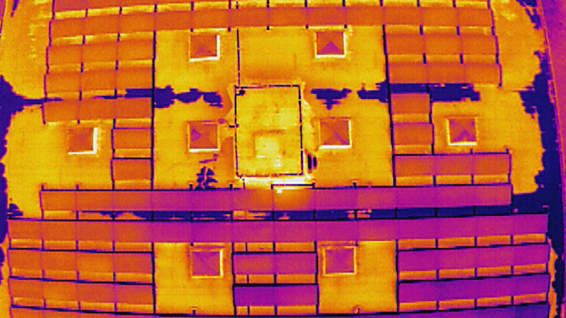
Thermal imaging cameras (also known as FLIR or thermal cameras) can quickly and efficiently detect such invisible damage. The problem is that these systems are often huge or installed in inaccessible locations on rooftops.
The solution for inspecting solar power plants: thermal imaging drone
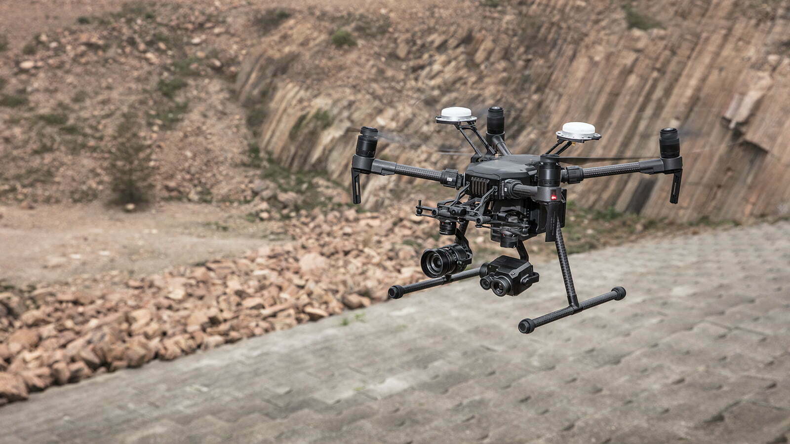
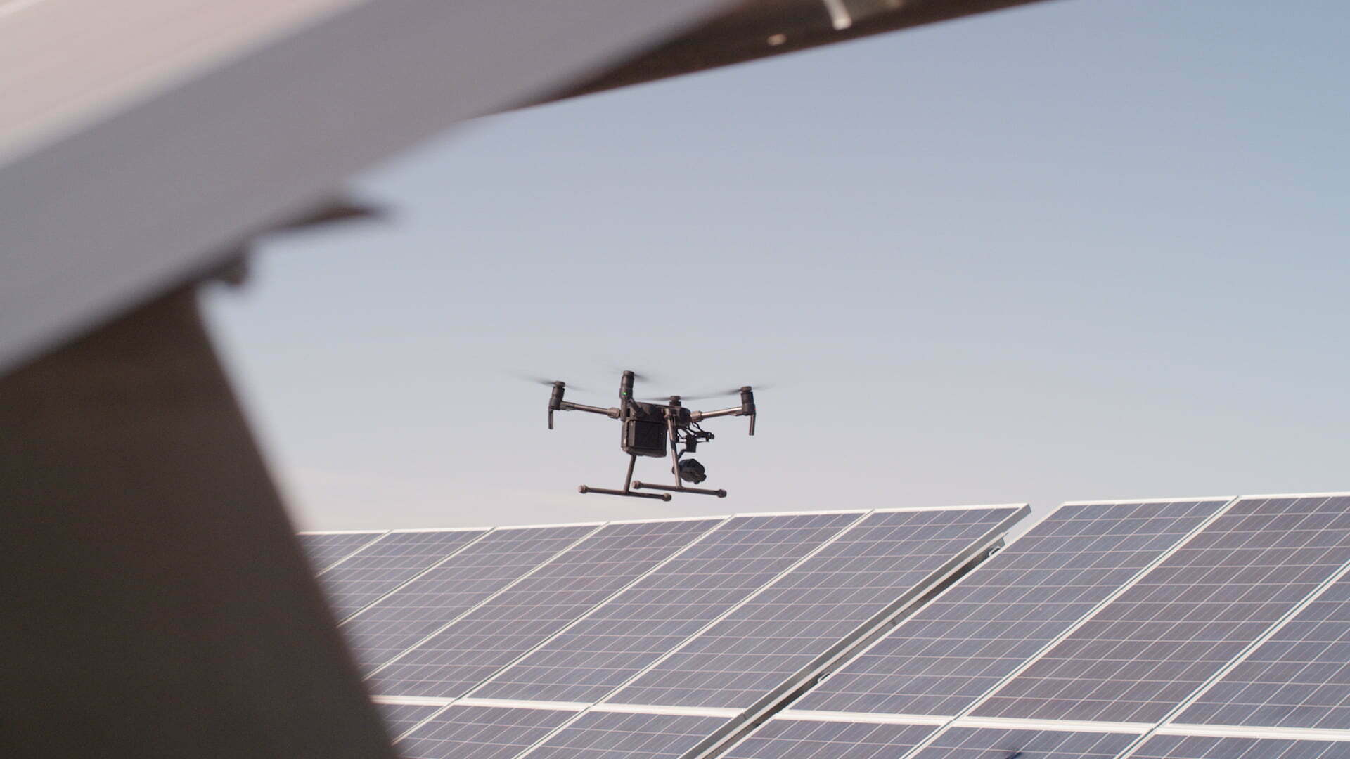
By combining a DJI Matrice With the 210 and the high-resolution dual thermal imaging camera Zenmuse XT2, we offer the perfect equipment for an efficient and accurate analysis of any photovoltaic system.
To locate faulty solar cells, the entire system must be surveyed with a camera drone. This allows visual irregularities to be identified and subsequently analyzed in detail.
To detect defective solar panels, the entire system must be converting solar energy. Inspection flights over solar power plants can therefore only be carried out during the day and in good weather. Experts assume a power output of around 50% of the nominal output is necessary to identify faulty solar modules.
Just presented DJI Your latest software in Enterprise Drones Area: DJI TERRA – The software solution from DJI It transforms drone data into digital 2D/3D models. Automatic flight planning and data acquisition thus become child's play.
Photograph, analyze, and visualize your surroundings with DJI TERRA – an easy-to-use software developed to transform real-world scenarios into digital ones.
Highlights Flight Planning
Area: Record data from a specific location, draw a square on a map, the software calculates the optimal flight paths to fly over the area and collect all the data.
Waypoint (waypoints): Freely and dynamically set a route on the map, the rest is taken care of. DJI TERRA, settings such as: optimal drone flight altitude for the desired detection zone, flight speed, camera position, Gimbal Pitch and angle.
Oblique (Dense/Slanted): Created with Oblique DJI TERRA offers excellent 3D models; the objects and flight paths are flown multiple times to obtain high image information for the ideal 3D experience from different viewing angles.
Highlights: Real-time mapping and detailed 3D models
Real-time mapping: With the real-time mapping function, you can quickly create reliable real-time 2D maps. Ideal for critical situations requiring rapid on-site decisions.
Fast Processing: With DJI TERRA will soon be creating 2D orthomosaics and 3D model reconstructions. Simply put, DJI TERRA transforms the drone into a flying 3D scanner. Ideal for industrial applications such as building reconstruction, accident reconstruction (police operation), construction project tracking, and inspection and monitoring of critical, hard-to-reach infrastructure such as viaducts, bridges, road sections, etc.
Simple data analysis
2D and 3D measurement tools: The DJI TERRA measuring tools are precise and reliable; simply measure distances, volumes, and areas in the images.
Photo Inspection: The photo inspection function is useful for detailed analysis, e.g., at an accident scene. Per DJI With TERRA, you have access to the original image in the 3D model; hotspots can be easily marked with a pin for later detailed analysis.
DJI TERRA works with Phantom 4 RTK, Phantom 4 Pro V2.0, Phantom 4 Pro + V2.0, Phantom 4 Pro, Phantom 4 Advanced and Phantom 4.
Have we sparked your interest? We would be happy to answer any further questions or provide you with a quote. Please call us at 032 511 11 03 or send us an email.
DJI, the world market leader in civilian drone and aerial imaging technology, today presented the Mavic 2 Enterprise Dual in front, a powerful, reliable and easy-to-transport drone with parallel built-in Thermal imaging and visual cameras. It allows professional drone pilots to deploy drones quickly and safely – even in challenging environments.
Target groups Mavic 2 Enterprise Dual
Police
Fire department
disaster relief
Rescue
Security
The Mavic 2 Enterprise Dual was developed in collaboration with FLIR Systems and is fundamentally based on the compact and foldable design of the Mavic Series 2. It also offers a range of advanced control functions and, through modular accessories, the same expansion options as the Mavic 2 Enterprise. Mavic 2 Enterprise Dual enables users to easily take temperature measurements and save recording data for efficient analysis. This creates direct added value in a wide range of industrial and time-critical applications, from infrastructure monitoring to rescue operations.
“Drones are being used more and more frequently in public safety operations or in everyday inspections,” explained Jan Gasparic, DJI Director of Strategic Partnerships. "As DJI and FLIR in 2015 the GimbalThe introduction of the Zenmuse XT camera opened up a wealth of new commercial applications for drones. With the Mavic 2 Enterprise Dual gives pilots the opportunity to carry out safe missions in a wide variety of environments and to fully concentrate on their task.”
High-performance and mobile FLIR thermal imaging technology
The Mavic 2 Enterprise Dual is equipped with two cameras mounted directly next to each other. The visual camera, with its high-resolution 4K sensor, captures images of the visible light spectrum, while the FLIR Lepton® thermal imaging camera, with its FLIR sensor, detects the heat emitted by objects. The interaction of both sensors enables nighttime operations, as well as operations in fog or heavy smoke. Users can... DJI Pilot App allows you to select different display modes and thus change the presentation of the recording data:
FLIR MSX® – FLIR's patented MSX (Multispectral Dynamic Imaging) overlays detailed visible light elements onto the thermal image, enhancing perceptible contours during real-time transmission. This helps pilots quickly identify and analyze critical image details that would otherwise be invisible to the naked eye.
Object measurement– Displays the average temperature of an object. This function allows pilots to observe objects and take measurements from a safe distance.
Area measurement– Displays the average, minimum, and maximum temperatures within a selected area. This display mode allows pilots to quickly and easily assess building components or infrastructure, for example, to determine if parts are overheating.
IsothermalUsers can define specific temperature ranges and thus restrict the display to these ranges. This gives pilots a clearer and higher-contrast view of target people or objects. Predefined profiles include those that assist rescue teams in searching for people or firefighters in analyzing fire sources. In addition, freely definable profiles can be created for other scenarios.
"Equipped with the FLIR Lepton, our smallest thermal micro camera Mavic 2 Enterprise “Dual offers a great opportunity to bring thermal imaging to more drone owners,” said Jim Cannon, President and CEO of FLIR. “This is our third collaboration with DJI developed product, and this latest collaboration between Thermal and FLIR is a significant step forward in making thermal imaging an essential element of the industry.
Modular accessories for even more possibilities
The Mavic 2 Enterprise Dual comes complete with accessories from Mavic 2 Enterprise Compatible. The accessories are securely attached to the drone and protected by the DJI The Pilot App is used. This accessory opens up new ways for pilots to make contact from the air. This revolutionizes the applications of drones, moving them away from a simple imaging tool and towards a productivity-enhancing, configurable platform.
headlightsThe dual spotlights emit 2,400 lumens of light, assisting pilots in conducting missions in darkness or low-light conditions. The spotlight is ideal for inspection or rescue operations.
LoudspeakersIt offers a maximum volume of 100 decibels (at a distance of 1 meter) and allows pilots to play back 10 saved voice recordings. During rescue operations, the speaker ensures direct communication with people in the immediate vicinity of the drone.
Collision warning lightThe flashing light is visible from up to 4,8 kilometers away. This assists pilots in safe operations in low light or at night. Furthermore, it better informs nearby drones or other aircraft about surrounding airspace activity.
Improved data security features
The Mavic 2 Enterprise Dual offers the same data security features as the [other devices] with regard to the protection of video, photo and log data. Mavic 2 EnterprisePhotos, videos, and flight data can be effectively protected for sensitive missions. It offers 24 GB of internal storage, password protection, and makes all access to drone functions and stored data traceable. With password protection enabled, users must enter their password every time they power on the drone, pair it with the remote control, or access the internal storage to gain full access. This new feature gives users exclusive access to the device and enhanced security. Password protection not only provides secure access to the drone's internal storage but also protects the data even if the drone is physically compromised.
The new GPS timestamp encodes the time, date, and location of each recording. This allows the pilot to provide accountability at any time and ensures that the recorded drone data is trustworthy when used for the inspection of critical infrastructure or in legal proceedings.
Additionally, for users subject to special security regulations, the "Local Data Mode" allows sending and receiving data via the internet directly from within the app. This mode offers extra protection for pilots flying in the vicinity of critical infrastructure or during sensitive missions.
Improved flight and airspace safety
Each Mavic2 Enterprise Dual is with DJI Equipped with Air Sense. Air Sense provides better situational awareness and makes the airspace safer. Air Sense uses a built-in receiver and automatically informs pilots about ADS-B signals from nearby aircraft or helicopters. Pilots receive this information through the DJI The Pilot App provides a real-time overview of the surrounding airspace directly on the user's mobile device. This gives professional drone pilots additional protection in busy airspace or during complex operations, such as fighting forest or brush fires, disaster relief, or infrastructure monitoring. DJI The Air Sense system is an important system for maintaining airspace safety when using drones.
The Mavic 2 Enterprise Dual utilizes the latest OcuSync 2.0 transmission system, making video and data transmission between the drone and remote control exceptionally stable, even in environments with significant interference, such as densely populated areas. The system's simultaneous use of the 2,4 GHz and 5,8 GHz frequency bands makes it more robust against interference and allows for separate allocation of downlink and uplink to the two frequency bands.
The Mavic2 Enterprise Dual uses vector-controlled electric motors in combination with efficient propellers for quieter flight. It has a maximum flight time of 31 minutes and a maximum speed of 72 km/h. Furthermore, the specially designed [propellers/engines] enable Mavic2 Enterprise The engineered, self-heating batteries can also be used in cold weather conditions down to -10 °C.
Price and availability
The selling price of Mavic 2 Enterprise The Dual, including remote control, battery, three modular accessories, and a carrying case with attachments, costs 3,259.- The Fly More Kit with two additional batteries, a battery charging station, a car charger, a USB cable, a shoulder bag and two additional propellers is available for 499.-
The Mavic 2 Enterprise Dual is now available from us. Call us on 032 511 11 03 or contact us via Email contact Let's go with us!
The University of Geneva has selected a drone solution from trenderia gmbh for its Geology/Volcanology department. The system was successfully handed over to the research team at the University of Geneva today. The drone will be used at various locations worldwide to study terrain and volcanoes.
The solution: Matrice 210 RTK with Zenmuse XT2 thermal camera
The Matrice 210 RTK of DJI is a solid water-resistant Enterprise Drone with an open system architecture for custom applications and functions. Gimbal Port enables the use of almost all DJI Enterprise Camera solutions. This system primarily utilizes the new ZENMUSE XT2 thermal camera. It offers unique features and is currently state-of-the-art in the field of flying thermal imaging cameras. The XT2 is equipped with a 4K camera and a FLIR thermal camera. RTK stands for Real-Time Kinematics and enables centimeter-accurate horizontal and vertical positioning of the drone. This precision allows for the development of repeatable flight paths. The resulting reliable and valuable visual data is indispensable for certain mapping applications.
Ground Station D-RTK GNSS
Drone DJI Matrice 210 RTK
Controller DJI Cendence with DJI Crystal Sky
Drone with ZENMUSE XT 2 camera and RTK-G positioning
We wish the team every success with the new drone.
Here you can find more information about Enterprise Drones
The brand new and cheapest Enterprise Drone from the company DJIA high-performance flight platform with special add-ons for mobile emergency response teams. Available now from trenderia.
Expand your capabilities directly at the deployment site – with the Mavic 2 EnterpriseAlways be flexible and prepared for any situation, anytime and anywhere.
Be an industry leader. With limitless opportunities.
Discover more options for flight operations thanks to the special connector for expansion modules. This connector allows the attachment of additional accessories and enables you to tailor performance for critical missions.
M2E Speaker
Communicate directly with ground crews during operations, effectively guiding pilots and local forces through the mission.
M2E Collision Warning Light
Conduct nighttime missions with greater safety, as other pilots can easily spot the drone in the operational area.
M2E headlights
Searching for people is easier than ever, thanks to the dual headlights for use in dark environments.
Your aircraft with your data. You remain in control.
Simply enter your password and gain full control over the aircraft and its functions. The intuitive login process ensures secure access to the aircraft's data at all times, preventing unauthorized access to sensitive information.
Always aware of the immediate airspace.
DJI AirSense avoids hazardous situations and improves airspace safety by providing immediate warnings about manned aircraft in the vicinity.
Fly safer than ever before.
The improved FlightAutonomy system allows omnidirectional obstacle detection.2 It consists of 8 high-resolution vision sensors and 2 infrared sensors on the sides of the Mavic 2 EnterpriseThe result? A powerful package of sensors that determine the relative speed and distance between the aircraft and its surroundings. This enables even more stable flight and hovering under a wide variety of complex environmental conditions.
Detect and avoid with ease.
The Advanced Pilot Assistance System (APAS) automatically detects objects near the drone during flight and avoids them automatically, even in confined spaces.
Refined image capture system for tactical and practical use.
The design of the image acquisition system focused on two features: supporting pilots during missions at the target and ensuring the security of the recorded data.
Zoom in. Zoom out.
Always close, but from a safe distance. Mavic 2 Enterprise It is equipped with a camera featuring 2x optical and 3x digital zoom. This allows for close-range operations without endangering the drone.
Trusted data.
Like an iOS or Android mobile device, the drone saves GPS date and time stamps of the recording in the image files. This enables applications in institutions or industries that require temporal accuracy and precision.
Mavic 2 EnterpriseWeighing only 905g, it's ideal for mobile task forces. Are you interested in the... Mavic 2 EnterpriseCall us: 032 511 11 03
DJI FlightHub is an integrated solution for managing drone operations and scaling larger flight operations for larger organizations. Its native compatibility with the Mavic 2 Enterprise, can DJI FlightHub can be integrated into your daily routine at any time, thus further increasing the operational efficiency of your organization's drone fleet.
Biel/Bienne, March 28, 2018 – trenderia gmbh has been an official partner since 2012. DJI Dealer, as a pioneer in the consumer drone segment with camera drones such as e.g. DJI phantom, Mavic We have grown enormously in recent years with Pro and Inspire 2.
We have recently become official DJI Enterprise BecomeWith the expansion in the area Enterprise We offer solutions that provide access to authorities, institutions and professional users. DJI Enterprise Solutions.
Product solutions for professional users
With the Enterprise We are opening up a rapidly growing market for professional drone applications with our solutions. Among the most exciting and widely used solutions are:
Location analysis
3D surveying
Heat measurements
All DJI Enterprise The drone fleet includes the following models:
Matrice 200 series
Agras MG 1-S
Matrice 100
Matrice 600 Pro
Phantom 4 Pro +
Phantom 4
Inspire 1
Areas of application for DJI Enterprise Solutions
We offer solutions for the following areas of application: .
agricultural sector
Plant advice
Irrigation management
Plant inspection
rinsing solutions
energy sector
Solar system analysis
Wind turbine analysis
Oil and gas facilities
power lines
AKW
public safety
Search and rescue (REGA etc.)
Fighting fires (fire brigade etc.)
Emergency response
Criminal prosecution
Media
Journalism
Cinematography
Wedding photography
Infrastructure
Transport networks
Mining
measurement
Construction
Real estate marketing
Location assignment
Building inspection
DJI Enterprise Drones in use
You are interested in a DJI Enterprise Solution? Ours DJI Our specialists are happy to provide advice and prepare an individual offer according to your wishes and plans.
Since 2012, trenderia gmbh's clients have included various public institutions, police authorities, universities, fire departments and various federal offices.
The Mavic Air is a masterpiece of engineering and a loyal companion on every adventure. The compact drone adopts the best features of the Mavic series and offers groundbreaking performance and functionality for the adventurer in each of us.
Highlights
32 megapixel spherical panoramas
Foldable & compact
3 axes Gimbal & 4K camera
Environment detection in 3 directions
Smart Capture
21 minutes flight time
Top speed: 68,4 km/h
3 axes Gimbal
The Mavic Air is the most compact drone to date from DJI, which use an extremely precise mechanical 3-axis Gimbal features. The triangular damper formation of the GimbalIt brings additional stability to every recording.
32 megapixel spherical panoramas
In addition to vertical, horizontal and 180° panoramic shots, the Mavic Air is able to stitch together as many as 25 photos in just 8 seconds to create a 32-megapixel spherical panorama.1 The images can be used immersively with the DJI Goggles will be displayed.
4K 100 Mbps Video
The Mavic Air records videos in crisp 4K 30 fps at 100 Mbps, for true UHD recordings.
The world in slow motion
1080p 120 fps slow-motion videos make cool scenes at high speed look even more epic.
HDR photos
New HDR algorithms intelligently adapt to lighting conditions and automatically select the correct exposure values. Overexposed or dark areas are processed for more natural transitions between highlights and shadows, while DSP acceleration allows for more efficient shooting.
12 Megapixel
The camera of Mavic Air features a 1/2.3” CMOS sensor with 12 megapixels, as well as an f/2.8 lens with a focal length of 24 mm.
8 GB internal memory
In addition to the Micro-SD card slot, the Mavic The Air has 8 GB of internal storage. This allows photos and videos to be saved directly on the aircraft and exported via the USB 3.0 Type-C port.
Design
Designed for adventurers, geometric elegance.
The arms of the Mavic The Air cameras fit perfectly against the aerodynamic chassis. An extremely robust magnesium alloy holds the integrated cameras in place, while the primary camera is recessed for better protection.
3D folding design
When folded, the Mavic Air is no longer or wider than a smartphone! Despite its compact form factor, the Mavic Air sets a completely new standard for a drone of this size.
Compact remote control
The dedicated remote control is, like the remote control of the Mavic The remote is foldable and features an ergonomic design that holds smartphones with maximum comfort. The control sticks are detachable and can be stored in slots on the remote for safe transport.
ActiveTrack
ActiveTrack can recognize up to 16 selectable targets2 simultaneously and allows you to switch between targets in flight.
With even greater precision and even more applications, ActiveTrack is able to track targets,
even when performing physically demanding activities.
Quick shots
Six different QuickShots are available: Rocket, Dronie, Circle, Helix, Asteroid and Boomerang.
QuickShots perform epic, pre-programmed selfie flight maneuvers.
Recordings could be made directly via the DJI The GO 4 app can be shared on social networks.
Smart Capture
Simple, intuitive, and fun. SmartCapture offers a new, interactive way to Mavic Control the drone with your hand. Launch and control the drone with hand gestures and take photos and videos as you wish.
TAPFLO
With TapFly, you can concentrate fully on recording. Simply tap a point on the display and the Mavic Air is on its way there! TapFly offers the following sub-modes to suit all situations:
Forward, Backward, Free and Coordinates.
Flight Autonomy 2.0
The high-performance FlightAutonomy 2.0 sensor system consists of the primary camera, forward-, rear-, and downward-facing vision sensors, a downward-facing infrared system, redundant IMU units, advanced VIO technology, and multiple processing cores. This sensor system gathers and processes information from the immediate surroundings, ensuring precise hovering and improved flight performance. The Advanced Pilot Assistance System (APAS) further enhances this. Mavic Air is now able to directly bypass obstacles in front of and behind it. Aerial adventures have never been safer or easier.
Improved Wi-Fi video transmission
DJI Goggles
Connect those Mavic Air with the DJI Goggles to experience adventures from an immersive bird's-eye view.
The Intelligent Flight Batteries of Mavic Air devices consist of extremely high-density lithium cells, offering a long flight time of up to 21 minutes.
The use of a sinusoidal drive architecture for the ESC units ensures a better motor commutation process and better efficiency of the motors and ESC units.
Experience the thrill of speed with a top-class drone, reaching speeds of up to 68 km/h4 in Sport mode.
The new Wi-Fi video transmission system offers the 2,4 and 5,8 GHz frequency bands, as well as a 720p live stream from a distance of up to 4 km.
Connect those Mavic Air with the DJI Goggles to experience adventures from an immersive bird's-eye view.
Yesterday, August 31, 2017, he presented DJI The drone innovations at IFA Berlin: DJI Phantom 4 Pro Obsidian Edition and DJI Mavic Pro Platinum Edition. As always, you can pre-order the products directly from us. Interested retailers can find more information here. register.
DJI Phantom 4 Pro Obsidian Edition
DJI Phantom 4 Pro Obsidian
Significant improvements compared to the previous model DJI Phantom 4 Pro.
Highlights
1” CMOS image sensor and a 4K 60fps camera
Magnesium Body in Obsidian Color
High-end anti-fingerprint alloy at Gimbal
The new standard in the Phantom 4 series – ideal for professional wedding photographers and aerial documentation of all kinds.
Pre-order now DJI Phantom 4 Pro Obsidian Edition (Private Customers)
DJI MAVIC PRO Platinum
DJI MAVIC PRO Platinum Edition
Significant improvements compared to the previous model DJI MAVIC PRO.
Highlights
11% more flight time (30 minutes)
60% Quieter (-4dB) – New Propellers
Color: Platinum (formerly grey)
New electronic speed controllers (ESCs) with lower power consumption
The Platinum Edition sets a new standard for the world's most advanced travel drone in a compact, foldable design. A must-have for globetrotters, vacationers, and travelers.
Pre-order now DJI MAVIC Pro Platinum (Private Customers)
DJI Go 4 App Update for the DJI SPARK Drone – Sphere Mode
In addition to the drone innovations, I present DJI, in DJI GO 4 App a master upgrade for the DJI SPARK. The smallest model in the company can now create so-called "Sphere" images. See example in the image below.
Sphere image, taken with the DJI SPARK drone. Cool stuff!