trenderia DJI Enterprise White WaveDesign logo trenderia DJI Enterprise White WaveDesign logo
Menu
  • Industries
    • Construction
    • authorities and government
    • Energy
    • Agriculture
    • Media and film
    • public safety
    • University and Research
    • Insurance
  • Platform
    • Matrice 4 series
    • Matrice 350 RTK
    • Matrice 30 series
    • Mavic 3 Enterprise Series
    • Mavic 2 Enterprise Series
    • Flycart 30 Delivery Series
    • Agras series
  • Solutions
    • Rent drones instead of buying them
    • Buy a drone for fawn rescue
    • Transport drone
  • Software
    • FLIR Thermal Studio Suite
    • Pixpro – 3D Photogrammetry
    • FlightHub
    • DJI GROUND
  • Sensors
    • DJI
    • DJI Skyport
  • Company
    • Jobs
    • Service & Support
      • Online repair request
      • DJI Maintenance Service
    • Enterprise Drone Blog
    • Brands
    • DJI Drone courses
      • DJI Academy – Flight School – Biel
    • Become a dealer
    • Timeline of DJI Drones
    • Imprint
  • Contact
  • Shop

T: 032 511 11 03

DJI Official Dealer

Author Archives: admin

New thermal imaging camera for DJI Drones

Posted in Uncategorized |

June 30, 2020

| by admin | How does

The UAV XT384 thermal imaging camera is the first thermal imaging camera that can be easily mounted on one of the most popular drones. The camera is incredibly lightweight, weighing only 42 grams including the mount. With a resolution of 384x288 pixels and a 13mm lens, this camera delivers high-contrast images at high altitudes. Never before has a thermal imaging camera been so small, light, and easy to mount.


interest aroused?
Order now at https://www.futuretrends.ch/uav-xt384-waermebildkamera.html

fawn camerathermocamwiseXT384

Novelty: DJI Hybrid camera H20/T

Posted in Enterprise Drones, Enterprise Payloads, Uncategorized |

June 26, 2020

| by admin | How does

With the new Matrice 300 RTK Series, launched DJI the new high-end hybrid camera H20/T.

"H" for Hybrid
Multi-sensor payloads that bring a whole new meaning to operational efficiency. Thanks to unparalleled intelligence and integrated design, unprecedented aerial imaging capabilities are available for a range of commercial drone applications.

Highlights of the new DJI Hybrid camera H20/T summarized for you

  • Protection class: IP44
  • 12 megapixel wide-angle camera
  • 20 megapixel zoom camera (23x zoom)
  • Radiometric thermal imaging camera 640x512px
  • Operating temperature: -20°C to 50°C
  • Active and electronic image stabilization
  • Laser distance measurement up to 1200m
  • Pinpoint Feature – Object tracking from a great distance
  • Night Scene Mode

Technical specifications Hybrid cameras H20/T

CategoryItemSpec
GeneralWeightZenmuse H20O: 678 ± 5 g
Zenmuse H20OT: 828 ± 5 g
GeneralDimensionsZenmuse H20: 150 × 114 × 151mm
Zenmuse H20T: 167 × 135 × 161mm
GeneralProtection classIP44K
GeneralOperating temperature-20°C to 50°C (temperature measurement is only available between -10°C and 50°C)
GeneralStorage temperature-20℃ to 60℃
Generallaser class1M (according to IEC/EN 60825-1:2014)
GeneralSupported aircraftMatrice 300 RTK
Gimbalrange of angular accuracy0,01 ° ±
GimbalMountingremovable
GimbalControllable areaNodding: -120° to +30°
Yaw: ±320°
GimbalMechanical areaNodding: -132,5° to +42,5°
Yaw: ±330°
Roller: -90° to +60°
zoom cameraSensor1/1,7" CMOS, 20 MP
zoom cameralensDFOV: 66,6° to 4°
Focal length: 6,83 to 119,94 mm (35 mm equivalent focal length: 31,7 to 556,2 mm)
Aperture: f/2.8 – f/11 (Normal), f/1.6 – f/11 (Night Scene)
Focus: 1 m to ∞ (wide angle), 8 m to ∞ (zoom)
zoom cameraFocus modeMF / AF-C / AF-S
zoom cameraExposure modeCar, Manual
zoom cameraExposure compensation±3,0 (1/3 step size)
zoom cameraMeasurement modePoint measurement, center-weighted measurement
zoom cameraAE lockSupports
zoom cameraElectronic lock1 – 1/8000 s
zoom cameraISO rangeVideo: 100 – 25600
Photo: 100 – 25600
zoom cameravideo Resolution3.840 x 2.160 at 30 fps, 1.920 x 1.080 at 30 fps
zoom cameraVideo formatMP4
zoom cameraVideo subtitlesSupports
zoom cameraPhoto size5.184 × 3.888 px
zoom cameraphoto formatJPEG
Wide angle cameraSensor1/2,3″ CMOS, 12 MP
Wide angle cameralensDFOV: 82,9°
Focal length: 4,5 mm (Equivalent to 24 mm in 35 mm format)
Aperture: f / 2.8
Focus: 1 m to ∞
Wide angle cameraExposure modeCars
Wide angle cameraExposure compensation±3,0 (1/3 step size)
Wide angle cameraMeasurement modePoint measurement, center-weighted measurement
Wide angle cameraAE lockSupports
Wide angle cameraExposure time1 – 1/8000 s
Wide angle cameraISO rangeVideo: 100 – 25600
Photo: 100 – 25600
Wide angle cameravideo Resolution1.920 × 1.080 px at 30 fps
Wide angle cameraVideo formatMP4
Wide angle cameraVideo subtitlesSupports
Wide angle cameraPhoto size4.056 x 3.040 px
Wide angle cameraphoto formatJPEG
Thermal imaging camera (Zenmuse H20T)SensorUncooled VOx microbolometer
Thermal imaging camera (Zenmuse H20T)lensDFOV: 40,6°
Focal length: 13,5 mm (Equivalent to 58 mm in 35 mm format)
Aperture: f / 1.0
Focus: 5 m to ∞
Thermal imaging camera (Zenmuse H20T)Digital zoom1x, 2x, 4x, 8x
Thermal imaging camera (Zenmuse H20T)video Resolution640 × 512 px at 30 Hz
Thermal imaging camera (Zenmuse H20T)Video formatMP4
Thermal imaging camera (Zenmuse H20T)resolution640 × 512 px
Thermal imaging camera (Zenmuse H20T)image formatR-JPEG (16 bit)
Thermal imaging camera (Zenmuse H20T)Pixel pitch12 μm
Thermal imaging camera (Zenmuse H20T)Spectral band8-14 μm
Thermal imaging camera (Zenmuse H20T)Heat Sensitivity (NETD)≤50 mk at f/1.0
Thermal imaging camera (Zenmuse H20T)Temperature measurement methodPoint measurement, area measurement
Thermal imaging camera (Zenmuse H20T)Recording bandwidth-40°C to 150°C (high amplification)
-40°C to 550°C (low gain)
Thermal imaging camera (Zenmuse H20T)Temperature errorSupports
Thermal imaging camera (Zenmuse H20T)Flat Field Calibration (FFC)Automatic / Manual
Thermal imaging camera (Zenmuse H20T)PaddlesWhite hot / Fulgurite / Iron Red / Hot Iron / Medicinal / Arctic / Rainbow 1 / Rainbow 2 / Hue / Black hot
laser rangefinderwavelength905 nm
laser rangefinderMeasuring range3-1.200 m (to a vertical surface with ≥12 m diameter and 20% remission)
laser rangefinderMeasurement accuracy± (0,2 m + D × 0,15 %)
D is the distance to a vertical surface
FeaturesOptical hybrid zoom23x
FeaturesMax. Zoom200x
FeaturesOne-click recordingOne click to save the video or image from 3 cameras (zoom, wide-angle and thermal imaging camera) simultaneously.
FeaturesPoint & AimDouble-click on the wide-angle/thermal camera view. The system will move the Gimbal automatically, to focus on the desired point.
FeaturesHigh-resolution raster imageSelect a desired area in a wide-angle camera view, and the zoom camera will automatically capture a series of 20-megapixel images of that area. These images are saved along with an overview image, allowing for a more detailed view.
FeaturesNight sceneSupported (zoom camera)
Featurestime stampIncluding GPS, date and time
StorageSupported SD memory cardsMicroSD card (Max. capacity: 128 GB, UHS-1 speed class U3 required)
StorageSupported file systemsFAT32 (≤ 32GB), exFAT (> 32GB)
StorageRecommended Micro SD memory cardsTOSHIBA EXCERIA PRO 32GB micro SD HC II
SanDisk_Extreme PRO 32GB 3 A1 micro SD V30 HC I
TOSHIBA EXCERIA PRO 64GB micro SD XC II
SanDisk_Extreme PRO 64GB 3 A2 micro SD V30 XC I
SAMSUNG EVO 128GB micro SD 3 XC I
TOSHIBA EXCERIA M303E 32GB micro SD HC I
TOSHIBA EXCERIA M303E 64GB micro SD XC I
TOSHIBA EXCERIA M303 128GB micro SD XC I
SAMSUNG EVO 64GB micro SD 3 XC I


enterprise payloadh20h20tpayload

Matrice 300 RTK – The new DJI Enterprise Drone Flagship

Posted in Construction, authorities and government, Energy, Enterprise Drones, public safety, University & Research, Uncategorized |

June 26, 2020

| by admin | How does

DJI presents the new 2020 DJI Enterprise Flagship: Matrice The M300 RTK industrial drone features four downward-facing rotors. Dual sensors in six directions ensure collision avoidance and safe navigation in complex flight environments. A "Drone Hands Over" function allows pilots to transfer control of the drone from one pilot to another during flight. The standard RTK (Real-Time Kinetic) enables centimeter-accurate navigation in challenging situations and difficult-to-access environments. The M300 is IP45 rated (water jet resistant) and suitable for use in harsh weather conditions; temperatures from -20°C to +60°C are therefore not a problem. DJI Also new are the "hot-swappable" batteries – they can be replaced while the drone is in operation, ensuring seamless operation and short ground times. Different Skyport configurations (single, dual, and upward), a mobile fast-charging case for all battery types, and 55 minutes of flight time round out the new model. Matrice 300 RTK from!

Highlights of the Matrice 300 RTK drones summarized for you

  • Maximum payload: 2,7 kg
  • Up to 55 minutes flight time
  • Maximum flight altitude: 5000m / 7000m with special propeller
  • 15km range
  • Operating temperatures -20° – 40°C
  • Hot Swappable Battery Packs
  • Waterproof: IP45 (water jets)
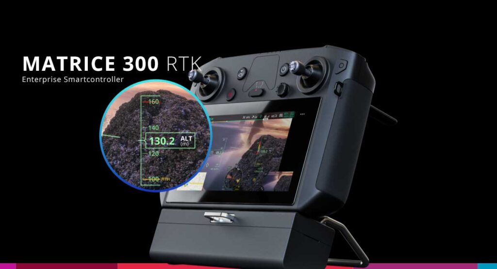
  • Enterprise Smart Controller
  • Fast charging case
  • New fully integrated payloads

Matrice 300 RTK – All flight-relevant systems are redundantly available.

All flight-relevant systems are fully redundant. Should an engine fail, the Matrice The 300 RTK still allows for safe landings. Additionally, the drone is equipped with dual sensors on all six sides, minimizing collisions caused by pilot error.

RTK as the new standard for precise flying

The Matrice The 300 RTK is a technological marvel; the drone flies your course with centimeter precision. Once recorded, scenarios can be flown again and again.

TB60 battery system

The new TB60 battery system gives the Matrice The 300 offers a flight time of up to 55 minutes! And the mission doesn't need to be interrupted when changing the battery. The batteries are hot-swappable, meaning they can be changed while the drone is running. After replacing the batteries, you can immediately resume flying.

Drone Hands Over Function

The drone can also be "handed over" between team members during flight using a "double touch" on a special button attached to their clothing. For example: The police are monitoring a city area X. The drone takes off and is no longer optimally controllable for the pilot who launched it, but is now near Team 2. The pilot from Team 2 can then take over the flying drone and continue flying it safely.

The Matrice The 300 RTK has a range of an incredible 15km!

M300 Enterprise Smart Controller

For the Matrice A completely new mobile smart controller was developed for the 300 RTK. The app has been completely redesigned and offers a new, intuitive, high-end GUI.

M300 Battery Station BS60 – Fast charging case for Matrice 300 RTK

The Battery Station BS60 was designed exclusively for the Matrice Developed for the 300 series, it offers fast charging capabilities for the new 8 x TB60 batteries and the 4 x Remote Controller batteries. The BS60 Battery Station can only be used with one Matrice 300 systems can be acquired.

Compatibility with existing payloads

The Matrice The 300 RTK is compatible with the Zenmuse XT, Zenmuse XT2, and the Z30 camera, as well as the brand-new H20/T hybrid cameras.

Technical information Matrice 300 RTK

CategoriesLabelSpecifications
AircraftDimensionsUnfolded, without propeller, 810 × 670 × 430 mm (L × W × H)
Folded, with propeller, 430 × 420 × 430 mm (L × W × H)
AircraftDiagonal axle spacing895mm
Aircraftweight (with a Gimbal downward)Approx. 3,6 kg (without battery)
Approx. 6,3 kg (with two TB60 batteries)
AircraftMax. Payload2,7 kg
AircraftMaximum takeoff weight9 kg
AircraftOperating frequencies2,4000 – 2,4835 GHz
5,725 – 5,850 GHz
Aircraftradiated power (EIRP)2,4000 – 2,4835 GHz:
29,5 dBm (FCC); 18,5 dBm (CE)
18,5dBm (SRRC); 18,5dBm (MIC)
5,725 – 5,850 GHz:
28,5 dBm (FCC); 12,5 dBm (CE)
28,5 dBm (SRRC)
AircraftFloating accuracy (mode “P” with GPS)Vertical:
±0,1 m (vision sensors activated)
±0,5 m (GPS enabled)
±0,1 m (RTK enabled)
Horizontal:
±0,3 m (vision sensors activated)
±1,5 m (GPS enabled)
±0,1 m (RTK enabled)
AircraftPositioning accuracyIf RTK is activated and installed:
Horizontal: 1 cm + 1 ppm
Vertical: 1,5 cm + 1 ppm
AircraftMaximum angular velocityPitch angle: 300°/s, yaw angle: 100°/s
AircraftMaximum pitch angle30° (Mode “P”, forward-facing vision sensors activated: 25°)
AircraftMaximum climb rate6 m/s (mode “S”)
5 m/s (mode “P”)
AircraftMaximum speed in vertical descent5 m/s (mode “S”)
3 m/s (mode “P”)
AircraftMaximum sink rate (incline)7 m/s (mode “S”)
AircraftMaximum airspeed23 m/s (mode “S”)
17 m/s (mode “P”)
AircraftMaximum flight altitude5.000 m (with 2110 propellers, take-off weight ≤ 7 kg) / 7.000 m (with 2195 propellers, take-off weight ≤ 7 kg)
AircraftMaximum wind resistance15 m / s
AircraftMaximum flight time55 min
AircraftSupported Gimbals of DJIZenmuse XT2/XT S/Z30/H20/H20T
AircraftSupported Gimbal-configurationsSingle downward-pointing Gimbal, dual downward trend Gimbals, single upward-pointing Gimbalupward and downward directed Gimbal, three Gimbals
AircraftProtection classIP45K
AircraftGNSSGPS + GLONASS + BeiDou + Galileo
AircraftOperating temperature-20°C to 50°C
Remote controlOperating frequencies2,4000 – 2,4835 GHz
5,725 – 5,850 GHz
Remote controlMaximum transmission range (without obstacles or interference)NCC/FCC: 15kmCE/MIC: 8kmSRRC: 8km
Remote controlradiated power (EIRP)2,4000 – 2,4835 GHz:
29,5 dBm (FCC), 18,5 dBm (CE)
18,5dBm (SRRC), 18,5dBm (MIC)
5,725 – 5,850 GHz:
28,5 dBm (FCC), 12,5 dBm (CE)
20,5 dBm (SRRC)
Remote controlExternal batteryWB37 Intelligent Battery
Capacity: 4.920mAh
Voltage: 7,6 V
Type: LiPo
Energy: 37,39Wh
Charging time (with BS60 Intelligent Battery charging station): 70 minutes (15°C to 45°C); 130 minutes (0°C to 15°C)
Remote controlIntegrated batteryType: 18650 lithium-ion battery (5.000 mAh at 7,2 V)
Charging: Use a USB charger with a specification of 12V/2A.
Rated power: 17 W
Charging time: 2 hours 15 minutes (Use a USB charger with a specification of 12V/2A)
Remote controlBattery lifeIntegrated battery: Approx. 2,5 hours
Integrated battery + external battery: Approx. 4,5h
Remote controlUSB power supply5V / 1,5A
Remote controlOperating temperature-20°C to 40°C
Vision systemObstacle detection areaForward / backward / left / right: 0,7 – 40 m
Up/down: 0,6 – 30 m
Vision systemField of View (FOV)Forward / backward / downward: 65° (H), 50° (V)
Left / right / up: 75° (H), 60° (V)
Vision systemOperating environmentSurfaces with clear contours and sufficient lighting (> 15 lux)
infrared sensorsObstacle detection area0,1 – 8 m
infrared sensorsField of View (FOV)30° (± 15°)
infrared sensorsOperating environmentLarge, diffusely reflecting obstacles (remission > 10%)
Upper and lower auxiliary lightingEffective lighting distance5 m
FPV CameraResolution960p
FPV CameraField of View (FOV)145°
FPV CameraFrame rate30 fps
Intelligent Flight BatterydesignationTB60
Intelligent Flight Batterycapacity5.935 mAh
Intelligent Flight Batterytension52,8 V
Intelligent Flight Batterybattery typeLiPo 12S
Intelligent Flight BatteryEnergy274 Wh
Intelligent Flight BatteryWeight of tableApprox. 1,35 kg
Intelligent Flight BatteryOperating temperature-20°C to 50°C
Intelligent Flight BatteryStorage temperature22°C to 30°C
Intelligent Flight Batterycharging temperature-20°C to 40°C
(If the temperature is below 5°C, the self-heating function is automatically activated. Charging at low temperatures can shorten the battery life.)
Intelligent Flight BatteryCharging timeUsing the BS60 Intelligent Battery Station:
220V input: 60 minutes (fully charge two TB60 batteries), 30 minutes (charge two TB60 batteries from 20% to 90%)
110V input: 70 minutes (fully charge two TB60 batteries), 40 minutes (charge two TB60 batteries from 20% to 90%)
BS60 Intelligent Battery Charging StationDimensions501 x 403 x 252 mm
BS60 Intelligent Battery Charging StationWeight of table8,37 kg
BS60 Intelligent Battery Charging StationMaximum capacityTB60 Intelligent Flight Battery × 8
WB37 Intelligent Battery × 4
BS60 Intelligent Battery Charging StationInput100-120VAC, 50-60Hz / 220-240VAC, 50-60Hz
BS60 Intelligent Battery Charging StationMax. input power1.070 W
BS60 Intelligent Battery Charging Stationoutput100-120 V: 750 W
220-240 V: 992 W
BS60 Intelligent Battery Charging StationOperating temperature-20°C to 40°C

Availability Matrice 300 RTK

The Matrice The 300 RTK is now available and can be purchased from us. Are you interested? We would be happy to advise you, answer any further questions, or provide you with a quote. Please call us at 032 511 11 03 or write to us via [email address/contact information]. Email.

DJI Drones used for epidemic control 2019-nCoV

Posted in Enterprise Drones, Uncategorized |

March 4, 2020

| by admin | How does

Drones are being used in the fight against the 2019-nCoV coronavirus. The fight against the 2019-nCoV epidemic has entered a critical phase; in China, over 77 people have already fallen ill (as of February 000, 23.02.2020). Combating the epidemic is a top priority in China.

What has DJI What was done? How were they done? DJI Have drones been used so far in the fight against the coronavirus in China?

According to media reports, DJI Drones are being used in over 50 counties and over 18 provinces to:

  • To broadcast safety information to passengers via loudspeaker
  • Monitoring and inspection of unprotected gatherings that facilitate the spread of the virus
  • Disinfecting villages and buildings from the air
    (Since February 3, 2020, with DJI Drones disinfected a total area of ​​over 200 million m² from the air in more than 3000 villages (over 4000 flight hours).

In which scenarios does the use of drones make sense:

  • Spraying – Spray disinfectant in contaminated areas (examples: bus stations, train stations, hospitals, workplaces)
  • Crowd Guiding & Traffic Control  – Crowd control and traffic management – ​​Thanks to the drone, no personnel are needed on site. The drone can patrol public areas such as streets in towns and villages to locate unprotected crowds, followed by instructions via loudspeaker.
  • Delivery Drone deliveries of food and medicine without human contact. Ideal and efficient for the rapid delivery of essential goods over short distances to people in quarantine. Since no human contact is necessary, the risk of virus transmission is significantly reduced.
  • Inspection & Broadcast Drones equipped with loudspeakers can be used to provide people with safety information and instructions from a safe distance.

Contact us for a personalized consultation on which drone can be used for which scenario.

2019-NcovBroadcastcrowncorona fightcorona dronecoronaviruscrowd guidancedeliveredinspectionspraytraffic controlvirus control

P4 Multispectral from DJI

Posted in Enterprise Drones, Uncategorized |

September 25, 2019

| by admin | How does

P4 Multispectral – Agricultural drone for precision agriculture and land management

DJI, the world leader in civilian drone and aerial imaging technology, today introduced the P4 Multispectral, setting a new standard for user-friendly agricultural drone applications. It was specifically developed for precision agriculture and land management.

The P4 Multispectral combines data from six separate sensors to assess plant health. Its resolution ranges from individual plants to entire fields, and it can also monitor insects, soil conditions, and weed growth. With the agricultural drone market expected to grow from USD 1,2 billion in 2019 to USD 4,8 billion in 2024 [1] , the P4 Multispectral provides the industry with a completely new tool. It allows for the optimization of crop yields and costs, while also enabling environmental specialists to monitor vegetation in the areas they manage.

“The P4 Multispectral comes with the promise of revolutionizing agriculture and land management by capturing precise data at the plant level – without requiring on-site experts to manually assess the condition,” explained Jan Gasparic, DJI Director of Strategic Partnerships. “By combining multispectral image processing in a reliable, efficient and cost-effective tool, we make DJI This revolutionary technology is becoming more accessible to professionals worldwide, so that these drones can be more easily integrated into their industries.”

Precise multispectral image processing

The P4 Multispectral offers a gimbalA stabilized imaging system with an integrated array of one RGB and five multispectral cameras (including red edge and near-infrared) captures both visible and invisible light. This data provides trained professionals with unique insights into vegetation stress, soil composition, salinity, and contamination. The integrated spectral sunlight sensor maximizes the accuracy and consistency of data acquisition when flights are conducted at different times of day.

Seamless integration with the flight planning app DJI Ground Station Pro allows pilots to switch between a preliminary NDVI (Normalized Difference Vegetation Index) view and the RGB view directly on-site, providing a better overview. Furthermore, the integrated RTK module and TimeSync ensure that every photo contains precise metadata, resulting in optimal photogrammetric accuracy down to the centimeter.

Compatibility with industrial workflows

The P4 Multispectral is compatible with standard workflows, including flight planning, mapping, and subsequent analysis with software from [Company Name]. DJI or other providers. By using the DJI Ground Station Pro allows users to repeatedly execute automated tasks, including flight planning, execution, and flight data management. To generate vegetation index maps, the collected data can be easily imported into DJI Terra or can be imported into a third-party software suite such as Pix4D Mapper or DroneDeploy. Additionally, P4 Multispectral users can improve RTK positioning accuracy even without an internet connection using the D-RTK 2 High-Precision GNSS Mobile Station and its support for all major satellite navigation systems. Alternatively, a third-party RTK network can be used via an iPad's internet connection.

Extremely powerful

Based on the chassis of the well-known Phantom, the P4 Multispectral utilizes the powerful OcuSync transmission system for an uninterrupted flight experience with low signal interference, improved image transmission, and a range of up to 7 km. [2] Each of the 2-megapixel cameras features a global shutter for precise image display during flight, with a maximum flight time of 27 minutes per battery.

The P4 Multispectral is now available from us available.
More information is available in the online shop. futuretrends.ch

agriculturalagricultural dronedjsenterpriseenterprisedronemultispectralp4phantom4phantom multispectralspectral

Drones pose a danger to aircraft and rescue services

Posted in authorities and government, public safety, Uncategorized |

August 20, 2019

| by admin | How does

Besides airspace violations near airfields, drones have also disrupted or even hindered emergency services on several occasions in recent years. For this reason, the Federal Office of Civil Aviation (FOCA) has produced two videos to inform drone pilots about the issue and the applicable regulations using illustrative examples. Direct link to the videos: https://www.bazl.admin.ch/bazl/de/home/gutzuwissen/drohnen-und-flugmodelle/multimedia.html

Image source: BAZL website


bazlblue lightdrone regulations Switzerlandlawsregulations

Different store opening hours in July 2019

Posted in Uncategorized |

July 10, 2019

| by admin | How does

Shop Biel

construction work

Due to construction work (water damage), our store will remain closed during the following period :

Mi, 10.07.2019

More information about DJI Phantom Day do you find here.

Company holidays

The shop will be closed for company holidays from July 15th, 2019 to August 2nd, 2019.

We are happy to be available for consultations and collections by appointment.

More information about DJI Phantom Day do you find here.

online shop futuretrends.ch

The support and shipping of online shop orders will not be affected by the company holidays.

EU Drone Regulation: New rules for private individuals and businesses

Posted in Construction, Energy, Enterprise Drones, Media and film, public safety, University & Research, Uncategorized |

June 19, 2019

| by admin | How does

The 12 most important questions about the new European drone regulation

Answered by: Christian Struwe, Head of Public Policy EMEA at DJI

We spoke with Christian Struwe, Head of Public Policy EMEA at DJI, discussing the significance of the new European drone regulation, the resulting changes and deadlines, and the impact on commercial drone users in Europe:

Q: Following the adoption of EU-wide rules setting out the technical requirements for drones on May 13, the European Commission adopted rules on drone operation on May 24. What is your opinion on this?

This day marked the final hurdle in a three-year process in which DJI alongside many other stakeholders in the drone industry, we have played a key role. We believe that these newly harmonized operational and technical requirements will help to enable and promote an even stronger market for the drone industry in Europe. Pilots can now take their drones abroad without having to worry about differing regulations, and commercial operators are offered new markets where they can expand their business under the same conditions as in their home country. This new harmonized drone regulatory framework opens the first door to greater flight safety, increased compliance and understanding among drone operators, and keeps European skies open for innovation.

Q: The regulation entered into force on 11 June 2019 upon publication in the EU Official Journal. Will there be any immediate effects?

The impact in 2019 will be very limited, as most of the changes will only take place in 2020 and the following years due to transition periods.

Q: Does the European regulation cover all aspects of drone use?

The European regulation establishes a common framework for rules across Europe, but there are still details that need to be determined by national authorities throughout Europe. This means that national authorities are empowered to define specifics, such as the particular airspace where drones are prohibited, which organizations are authorized to train and certify drone pilots, and what exactly this training should entail. Compare it to today's road traffic regulations: you need a driver's license, and you can use it throughout Europe, but where and how you obtain it can vary significantly from country to country.

Q: Now to the new regulation: How does it differ from the current national regulations?

The EU regulation has adopted a risk-based approach as far as possible. Several member states have applied the same principles in recent years, so there may not be any major changes. What is new in some jurisdictions is that the regulations cover aviation aspects (air-to-air and air-to-ground risks) as well as safety, data protection, and environmental considerations. Risk-based means that the type or purpose of the operation is not decisive, but only the expected risk. Professional and recreational pilots enjoy the same rights and obligations and can operate in the Open, Specific, and Certified categories if they meet the criteria.


Examples of the risks regulated in the new regulation are:


– Flight over or near people

– Flights near airports

– Weight of the drone

– Noise pollution

– Right to privacy


Q: Let's look at the individual categories. What are they and how are they determined?

Low-risk operations are grouped under the "Open" category: these do not require prior authorization, and users can operate according to the rules and obligations of the "Open" category. The "Specific" category applies to operations deemed to carry a medium risk and requires prior authorization from a competent authority—either by following a standard scenario or through an individual risk assessment using the SORA methodology, outlining how the mission can be conducted safely. The "Certified" category encompasses high-risk operations: this means you need a certified drone, a licensed pilot, and a company authorized by a competent authority.

Q: You said the risk assessment is a combination of the drone's weight and the proximity of its operation to people. That sounds like a matrix system for categorizing drones. What does that look like?

The drone classes for the "Open" category are as follows:

The lightest class relevant for commercial users is C1, which means that drones under 900g are permitted to fly near people, but not directly over crowds or where uninvolved persons are expected. Class C2, up to a takeoff weight of 4kg, will be applicable for many commercial applications. This allows flying at a safe distance from people, provided the speed can be reduced to 3km/h. An example application would be mapping a construction site outside urban areas with a P4RTK. Class C3 is the heaviest category of standard products for professional users: To qualify for the "Open" category, the pilot must operate at a safe distance from urban areas. Inspecting wind turbines in remote areas with an M210 RTK is a typical example. This mix opens the door to many authorization-free inspection and surveying tasks, which is an improvement for both pilots and companies.

Q: Many commercial activities will still fall into the "Specific" category. How much effort will be required to obtain an operating permit?

So-called Standard Scenarios (STS) are being developed, which should cover most deployments. The operator must explain or demonstrate that the use case falls under an STS. If not, a full SORA assessment is required. STS describe the risk mitigation measures and the technical requirements. Currently, the STS are still under development, and we expect two sets of STS by the end of 2019. We consider the development of the STS a major challenge that must be addressed by the European regulation to ensure legal certainty after the transition periods have expired.

Standard scenarios could include aerial mapping over a populated area or the inspection of linear infrastructure near urban areas, as well as the use of drones by rescue services.

Q: What will happen to the exemptions and regulations already granted?

Until July 2020, pilots can still operate under the applicable national regulations. They can continue to apply for authorization or exemption based on these regulations. From July 2020 onwards, previously granted authorizations and exemptions can be used until July 2022. After July 2022, only EU regulations will apply.

Q: Up until now, government operations (e.g., military, customs, police, fire department, etc.) have received a general exemption. Do you expect this to continue?

Yes, this requirement for public safety operations is already included in the opinion of the European Aviation Safety Agency. We assume that government agencies will be authorized to operate regardless of the drone class and category.

Q: Let's consider the technical requirements. Is it still possible for commercial users to design a drone program with currently available models?

Absolutely. Although there will be new CE requirements, the transition period will last until 2022. The exact technical requirements are currently being negotiated. Depending on the drone class, there will be different requirements. For example, drones in classes C1-C3 will have to have specific serial numbers and electronic identification. These are features that are already mandatory in some European countries. Other requirements include, for example, data connection protection (i.e., encryption) and lighting (i.e., collision avoidance signal). DJI-models already meet today's requirements, such as the Mavic 2 Enterprise and the Matrice Series V2.

Q: Do you foresee any other changes that will make it easier for commercial users to use?

The uniform maximum altitude of 120m will facilitate operations and is slightly higher than what some countries currently allow. Automated and autonomous flights will be easier, and since the primary risk is defined in terms of people rather than buildings, operations in urban areas will be simpler.

Q: Finally, what would you consider the biggest challenge on the road to 2022, and what would you describe as the greatest benefit for the commercial drone community?

The biggest challenge is ensuring that European states implement the regulation uniformly and apply it as intended. So far, there has been very little coordination of drone regulations, and some countries have even used this to build up their own national industries. To achieve a functioning market, these developments must be overcome. If we succeed, I believe the benefits are endless, and there is a good prospect for the widespread commercialization of drones: users have the entrepreneurial spirit and the desire to go beyond where we are now; the industry can provide the platforms for this; and finally, we have the regulations that allow it.

More information: Contact

djsdrone regulationsora

The integrated supercomputer Manifold 2 transforms DJI Drones in autonomously operating robots

Posted in Enterprise Drones, University & Research |

May 28

| by admin | How does

DJI, the world market leader in civilian drones and aerial imaging technology, today presented the Manifold 2. The particularly compact yet powerful onboard computer was specifically designed for use on DJI Drones developed to enable the next generation of autonomous robotics solutions. With the additional computing power of Manifold 2, users can process complex image data directly on the drone and get immediate results. Drones can also be programmed to fly autonomously, identify objects, and avoid obstacles.

"Through partnerships with leading technology companies in the field of chip development, we are now able to DJI “To transform drones into intelligent robots that can perform complex computing tasks and advanced image processing even during flight,” he explained. DJI Jan Gasparic, Director of Strategic Partnerships, said: “Manifold 2 greatly expands the application scenarios for our drones. It gives companies, developers, and scientists the opportunity to develop state-of-the-art, autonomous flight robotics solutions for virtually any industry or task.”


Manifold 2 It is available in two high-performance versions. Depending on the task, users can choose between the Intel® Core™ i7-8550U CPU or the NVIDIA® Jetson™ TX2 supercomputer-on-a-module with powerful AI computing for edge applications. Both versions are equipped with leading DJI Enterprise Drones are compatible and can be fully integrated into the internal control system, such as the Matrice The 210 and 600 series can be integrated. The powerful SDK gives developers direct access to sensors and flight controllers, thus enabling seamless integration into the system. DJI-Ecosystem of software and hardware.

Each Manifold 2 has USB, UART, and CAN ports, allowing developers to connect and build upon multiple Manifold 2 processors to create new solutions. DJI To transform drones into specialized flying robots for specific applications and industries.

"DJI “Manifold 2 not only enables advanced image recognition, environmental sensing, and navigation, as already known from the patented AMROS™ and Perceptive Navigation® platforms, but also makes it possible to use artificial intelligence directly at the edge – on the device itself – one of the hallmarks of Automodality's software and services for industrial inspections,” said Ed Koch, Chief Technology Officer at Automodality, a leading company in the development of autonomous drone solutions. “With Manifold 2, the drone can now capture and analyze its environment in real time, and thanks to Automodality, the DJI Matrice 210 can also fly autonomously in places where flights were previously not possible, such as where GPS or radio frequencies are not available, but where particularly important and usable information is located.”


Availability

DJI Manifold 2 is available today via the official channels. DJI Enterprise Available at retailers worldwide. Manifold 2 is equipped with the following: DJI Compatible products: Matrice 210 series, Matrice 600 series as well as N3 and A3 flight controllers. For more information here .

djsdjs enterprisemanifold-2

Matrice 200 Series V1 vs. V2

Posted in Enterprise Drones, Uncategorized |

May 17

| by admin | How does

In April 2019, he presented DJI the new Enterprise Drone Series: Matrice 200 Series V2 under the slogan: Indestructible engineering. Future-oriented adaptability.

DJI Matrice 210 RTK V2 - Fully equipped with RTK GPS, ZENMUSE XT2, ZENMUSE Z30

DJI Matrice 210 RTK V2 – Fully equipped with RTK GPS, ZENMUSE XT2, ZENMUSE Z30

DJI has not promised too much, the technological innovations of DJI Matrice V2 series These features are groundbreaking and essential for demanding field use. The system has been optimized for professional, industrial, and rugged applications. We've been waiting a long time for some of these innovations.

This article will show you the most important system-level innovations. Visually, the series hasn't changed much; externally, there's a new beacon (anti-collision light), and the GPS antennas in the RTK version have been redesigned.

Functional update: Beacon

Thanks to the BEacon, the Matrice The 200 Series V2 is visible at long distances. The entire lighting system, including the beacon, can be deactivated via app for critical operations.

Optical and functional update: Matrice 210 RTK V2 

The Matrice 210 RTK with D-RTKv2 and Network RTK

The most important upgrades are listed below. Matrice 200 Series V1 vs. V2 listed:

For payloads from third-party providers such as... Skyport Payloads can the Gravity of the drone The drone will be recalibrated. Data from the drone to the controller is now encrypted with AES 256. Ideal for critical data that is only accessible to the operational team (police, fire department, counter-terrorism, and emergency services). AES 256 This corresponds to one of the latest encryption technologies for secure digital data transmission. Another new feature is that the old and small TB50 batteries are no longer used. Matrice 200 V2 Series It only supports the high-performance TB55 batteries from DJIIn our opinion, the coolest upgrade is the new data transmission technology. OccuSync 2.0 known from Mavic 2Stable, secure and uninterrupted image transmission over distances of up to 5km (EU). All Matrice V2 drones now support the ZENMUSE X7 for high-resolution, high-end images.

Have we sparked your interest? We would be happy to answer any further questions or provide you with a quote. Please call us at 032 511 11 03 or send us an email.


djsEnterprise dronesindustrial dronesmatreice210v2matrice200v2matrice210rtkv2
← Prev 1 ... 5 6 7 8 9 Next →

Search

Recent Posts

  • trenderia at SPIK – Swiss Police Informatics Congress 2026
  • Christmas greetings from trenderia & futuretrends.ch – Opening hours
  • Rent drones instead of buying them: This is how you reduce costs and stay technologically ahead.
  • DJI Matrice 4T for fawn rescue
  • Showroom clearance sale – individual items & samples available at low prices!

Category

  • Application
  • Construction
  • authorities and government
  • Consumer drones
  • DJI Dock
  • Drone regulation
  • Energy
  • Enterprise Drones
  • Enterprise Drones
  • Enterprise Payloads
  • Events
  • Events
  • Infographics Drones
  • Agriculture
  • Media and film
  • public safety
  • fawn rescue
  • Rescue
  • University & Research
  • Uncategorized
  • measurement
  • Insurance

DJI Enterprise Newsletter

More exclusive DJI Enterprise Newsletter - The newsletter for professional drone users. Be the first to know about new products and services. DJI Enterprise Drones, payloads, add-ons and software solutions in the Enterprise Drone environment.

DJI Enterprise Gold Partner Switzerland© 2026 trenderia gmbh - The Future is now!
DJI Dealer since 2013, DJI Enterprise Dealer since 2017
trenderia gmbh - Spärsstrasse 2 - CH-2562 Port